

GEOGRAPHICAL INFORMATION SYSTEMS (GIS) & LANDS

-
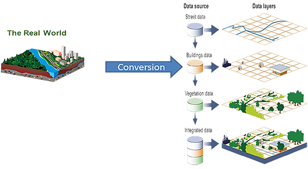
Building Database layers
-
Management of civil infrastructure
-
Homeland Security- Emergency command & control centers
-
Call centers with GIS components

-
Electronically Secured
-
Lands And Deeds Documents - Tracking & Verification

-
Integrated GIS
-
Cadaster Management
-
Workflow Management System
-
Increase revenue collection

-
Aerial Photography
-
LiDAR
-
Satellite imagery
GIS solutions-Building the GIS Database
Managing the underground infrastructure (water, sewage, drainage, gas , electricity etc.)
An integrated digital underground view of all facilities that supports efficient planning and construction of civil infrastructure is the key for minimizing the safety and cost concerns associated with locating underground utilities.

Secured Land Title
Secured Land title with unique electronic characteristics:
Special chip coded with the information of the certificate (name of the owner, ID No., Survey drawing of the plot) and owners biometric identifiers, owner's picture and fingerprints, current mortgage indicator and indication for payment of annual fees
Resulting in land fraud prevention and Increasing the confidence in the reliability of the document in the public´s and private sector´s eyes
Lands Management

Computerized distributed land management information system –for better and more efficient land management, focusing on faster and transparent service to the public, secured and fully backed up in case of disaster.
Covers the entire land titling and registration processes – lease, assignment, mortgage, caveat, sub-lease, allocation, re-parceling etc.
Mapping- LiDAR, Aerial photo, satellite
